


|
 |
 |
| |
State of Alaska Coloring Page Sheets
The 50 States coloring pages
|
|
Alaska coloring pages are a fun way to teach Pre-K through 3rd grade students history, geography and demographics,
and for elementary students to learn about their own (and other) states.
|
| LIST of States |
|
|

AK - Alaska
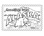
Alaska Postage Stamp - USPS State Stamp
Alaska State Quarter - 50 State Quarter
Alaska State Flag - State Flag to Color
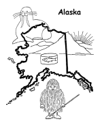
Alaska Map 1 - State Outline Map to Color
Alaska Map 2 - State Outline Map to Color
Alaska Map 3 - State Outline Map to Color
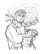
Alaska Iditarod - The Iditarod Trail Sled Dog Race
Alaska boy - Alaska was the 49th state in 1959
|
Alaska is the largest state of the United States by area; it is situated in the northwest extremity of the North American continent,
with Canada to the east, the Arctic Ocean to the north, and the Pacific Ocean to the west and south, with Russia further west across the
Bering Strait. Approximately half of Alaska's 698,473 residents live within the Anchorage metropolitan area. As of 2009, Alaska remains
the least densely populated state of the United States.
The U.S. Senate approved the purchase of Alaska from the Russian Empire on March 30, 1867, for $7.2 million at about two cents per acre.
The land went through several administrative changes before becoming an organized territory on May 11, 1912, and the 49th state of the U.S.
on January 3, 1959.
Alaska is the largest state in the United States in land area at 586,412 square miles, over twice the size of Texas, the next largest state.
Alaska is larger than all but 18 sovereign countries. Without Alaska, Brazil and Australia are larger than the United States. Counting
territorial waters, Alaska is larger than the combined area of the next three largest states: Texas, California, and Montana. It is also
larger than the combined area of the 22 smallest U.S. states.
Please note, we gladly accept submissions from state and local government agencies and departments (Department(s) of tourism, agriculture, etc.)
for display of additional state coloring pages on our site. In addition we accept submissions from established and recognized industries, or local
places of interest (cities, parks, attractions) that may make available quality content that is specific to a particular state. Contact us if
you have the capability and authority to provide such content, we would be happy to promote your state, city, attraction, event, etc.!
*** State information courtesy of Wikipedia ***
|
|
|
|
|
|

|