


|
 |
 |
| |
State of Michigan Coloring Page Sheets
The 50 States coloring pages
|
|
Michigan coloring pages are a fun way to teach Pre-K through 3rd grade students history, geography and demographics,
and for elementary students to learn about their own (and other) states.
|
| LIST of States |
|
|

MI - Michigan Coloring Pages
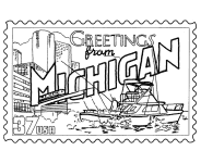
Michigan Postage Stamp Coloring Page - USPS State Stamp
Michigan State Quarter Coloring Page - 50 State Quarter
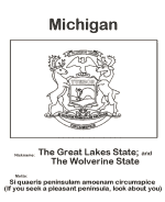
Michigan State Flag Coloring Page - State Flag to Color
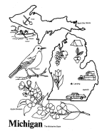
Michigan Map 1 Coloring Page - State Demographic Map to Color
Michigan Map 2 Coloring Page - Easy State Shape Outline Map
|
Michigan is a U.S. state located in the Great Lakes Region of the United States of America. The name Michigan is a French adaptation of the
Ojibwe word mishigama, meaning "large water" or "large lake".
Michigan is the eighth most populous state in the United States. It has the longest freshwater shoreline of any political subdivision in the
world, being bounded by four of the five Great Lakes, plus Lake Saint Clair. In 2005, Michigan ranked third among US states for the number
of registered recreational boats, behind California and Florida. Michigan has 64,980 inland lakes and ponds. A person in the state is
never more than six miles (10 km) from a natural water source or more than 87.2 miles (140.3 km) from a Great Lakes shoreline. It is the
largest state by total area east of the Mississippi River.
Michigan is the only state to consist entirely of two peninsulas. The Lower Peninsula, to which the name Michigan was originally applied,
is often dubbed "the mitten" by residents, owing to its shape. When asked where in Michigan one comes from, a resident of the Lower Peninsula
may often point to the corresponding part of his or her hand. The Upper Peninsula (often referred to as "The U.P.") is separated from the
Lower Peninsula by the Straits of Mackinac, a five-mile (8 km)-wide channel that joins Lake Huron to Lake Michigan. The Upper Peninsula is
economically important for tourism and natural resources.
Please note, we gladly accept submissions from state and local government agencies and departments (Department(s) of tourism, agriculture, etc.)
for display of additional state coloring pages on our site. In addition we accept submissions from established and recognized industries, or local
places of interest (cities, parks, attractions) that may make available quality content that is specific to a particular state. Contact us if
you have the capability and authority to provide such content, we would be happy to promote your state, city, attraction, event, etc.!
*** State information courtesy of Wikipedia ***
|
|
|
|
|
|

|