


|
 |
 |
| |
State of Missouri Coloring Page Sheets
The 50 States coloring pages
|
|
Missouri coloring pages are a fun way to teach Pre-K through 3rd grade students history, geography and demographics,
and for elementary students to learn about their own (and other) states.
|
| LIST of States |
|
|

MO - Missouri Coloring Pages
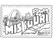
Missouri Postage Stamp Coloring Page - USPS State Stamp
Missouri State Quarter Coloring Page - 50 State Quarter
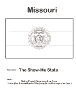
Missouri State Flag Coloring Page - State Flag to Color
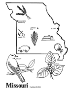
Missouri Map 1 Coloring Page - State Demographic Map to Color
Missouri Map 2 Coloring Page - Easy State Shape Outline Map
|
Missouri is a U.S. state located in the Midwestern United States, bordered by Iowa, Illinois, Kentucky, Tennessee, Arkansas, Oklahoma,
Kansas and Nebraska. Missouri is the 18th most populous state with a 2009 estimated population of 5,987,580. It comprises 114 counties and
one independent city. Missouri's capital is Jefferson City. The four largest urban areas are St. Louis, Kansas City, Springfield, and Columbia.
Missouri was originally acquired from France as part of the Louisiana Purchase and became defined as the Missouri Territory. Part of the
Missouri Territory was admitted into the union as the 24th state in August 10, 1821.
Missouri mirrors the demographic, economic and political makeup of the nation with a mix of urban and rural culture. It has long been
considered a political bellwether state. With the exceptions of 1956 and 2008, Missouri's results in U.S. presidential elections have
accurately predicted the next President of the United States in every election since 1904. It has both Midwestern and Southern cultural
influences, reflecting its history as a border state. It is also a transition between the Eastern and Western United States, as St. Louis
is often called the "western-most Eastern city" and Kansas City the "eastern-most Western city." Missouri's geography is highly varied.
The northern part of the state lies in dissected till plains while the southern part lies in the Ozark Mountains a (dissected plateau),
with the Missouri River dividing the two. The confluence of the Mississippi and Missouri River rivers is located near St. Louis
Please note, we gladly accept submissions from state and local government agencies and departments (Department(s) of tourism, agriculture, etc.)
for display of additional state coloring pages on our site. In addition we accept submissions from established and recognized industries, or local
places of interest (cities, parks, attractions) that may make available quality content that is specific to a particular state. Contact us if
you have the capability and authority to provide such content, we would be happy to promote your state, city, attraction, event, etc.!
*** State information courtesy of Wikipedia ***
|
|
|
|
|
|

|