


|
 |
 |
| |
State of North Carolina Coloring Page Sheets
The 50 States coloring pages
|
|
North Carolina coloring pages are a fun way to teach Pre-K through 3rd grade students history, geography and demographics,
and for elementary students to learn about their own (and other) states.
|
| LIST of States |
|
|

NC - North Carolina
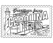
North Carolina Postage Stamp Coloring Page - USPS State Stamp
North Carolina State Quarter Coloring Page - 50 State Quarter
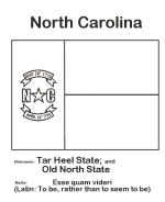
North Carolina State Flag Coloring Page - State Flag to Color
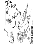
North Carolina Map 1 Coloring Page - State Demographic Map to Color
North Carolina Map 2 Coloring Page - Easy State Shape Outline Map
North Carolina Seal - Seal of the State to color
|
North Carolina is a state located on the Atlantic Seaboard in the Southern United States.
North Carolina contains 100 counties. Its capital is Raleigh, and its largest city is Charlotte.
Spanish colonial forces were the first Europeans to make a permanent settlement in the area, when the Juan Pardo-led Expedition built
Fort San Juan in 1567. This was sited at Joara, a Mississippian culture regional chiefdom near present-day Morganton in the western
interior. This was 20 years before the English established their first colony at Roanoke Island. North Carolina became one of the
English Thirteen Colonies, and was originally known as Province of Carolina.
On May 20, 1861, North Carolina was one of the last of the Confederate states to declare secession from the Union, to which it was restored
on July 4, 1868. The state was the location of the first successful controlled, powered and sustained heavier-than-air flight, by the
Wright brothers, at Kill Devil Hills, approximately 6.4 miles south of Kitty Hawk on December 17, 1903. It is a fast-growing
state with an increasingly diverse economy and population. As of July 1, 2009, the population was estimated to be 9,380,884 (a 16.7% increase
since April 1, 2000). Recognizing eight Native American tribes, North Carolina has the largest population of Native Americans of any state
east of the Mississippi River.
North Carolina has a wide range of elevations, from sea level on the coast to 6,684 feet in the mountains. The coastal plains are
strongly influenced by the Atlantic Ocean. Most of the state falls in the humid subtropical zone. More than 300 miles from the
coast, the western, mountainous part of the state has a subtropical highland climate
Please note, we gladly accept submissions from state and local government agencies and departments (Department(s) of tourism,
agriculture, etc.) for display of additional state coloring pages on our site. In addition we accept submissions from established and
recognized industries, or local places of interest (cities, parks, attractions) that may make available quality content that is specific
to a particular state. Contact us if you have the capability and authority to provide such content, we would be happy to
promote your state, city, attraction, event, etc.!
*** State information courtesy of Wikipedia ***
|
|
|
|
|
|

|