


|
 |
 |
| |
State of Ohio Coloring Page Sheets
The 50 States coloring pages
|
|
Ohio coloring pages are a fun way to teach Pre-K through 3rd grade students history, geography and demographics,
and for elementary students to learn about their own (and other) states.
|
| LIST of States |
|
|

OH - Ohio Coloring Pages
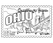
Ohio Postage Stamp Coloring Page - USPS State Stamp
Ohio State Quarter Coloring Page - 50 State Quarter
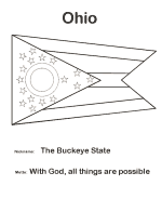
Ohio State Flag Coloring Page - State Flag to Color
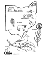
Ohio Map 1 Coloring Page - State Demographic Map to Color
Ohio Map 2 Coloring Page - Easy State Shape Outline Map
Soap Box Derby - Derby Downs in Akron, Ohio
|
During the 18th century, the French set up a system of trading posts to control the fur trade in the region. In 1754, France and Great Britain
fought a war that was known in North America as the French and Indian War and in Europe as the Seven Years War. As a result of the Treaty of
Paris, the French ceded control of Ohio and the remainder of the Old Northwest to Great Britain.
Pontiac's Rebellion in the 1760s, however, posed a challenge to British military control. This came to an end with the colonists' victory
in the American Revolution. In the Treaty of Paris in 1783, Britain ceded all claims to Ohio country to the United States
The United States created the Northwest Territory under the Northwest Ordinance of 1787. Slavery was not permitted in the new territory.
Settlement began with the founding of Marietta by the Ohio Company of Associates, which had been formed by a group of American Revolutionary
War veterans. Following the Ohio Company, the Miami Company (also referred to as the "Symmes Purchase") claimed the southwestern section, and
the Connecticut Land Company surveyed and settled the Connecticut Western Reserve in present-day Northeast Ohio.
The old Northwest Territory originally included areas previously known as Ohio Country and Illinois Country. As Ohio prepared for statehood,
the Indiana Territory was created, reducing the Northwest Territory to approximately the size of present-day Ohio plus the eastern half of the
Lower Peninsula of Michigan and the eastern tip of the Upper Peninsula.
Under the Northwest Ordinance, areas of the territory could be defined and admitted as states once their population reached 60,000. Although
Ohio's population numbered only 45,000 in December 1801, Congress determined that the population was growing rapidly and Ohio could begin the
path to statehood. The assumption was that it would exceed 60,000 residents by the time it was admitted as a state.
On February 19, 1803, President Jefferson signed an act of Congress that approved Ohio's boundaries and constitution. However, Congress had
never passed a resolution formally admitting Ohio as the 17th state. The current custom of Congress declaring an official date of statehood
did not begin until 1812, with Louisiana's admission as the 18th state. Although no formal resolution of admission was required, when the
oversight was discovered in 1953, Ohio congressman George H. Bender introduced a bill in Congress to admit Ohio to the Union retroactive to
March 1, 1803. At a special session at the old state capital in Chillicothe, the Ohio state legislature approved a new petition for statehood
that was delivered to Washington, D.C. on horseback. On August 7, 1953 (the year of Ohio's 150th anniversary), President Eisenhower signed an
act that officially declared March 1, 1803 the date of Ohio's admittance into the Union.
Please note, we gladly accept submissions from state and local government agencies and departments (Department(s) of tourism, agriculture, etc.)
for display of additional state coloring pages on our site. In addition we accept submissions from established and recognized industries, or local
places of interest (cities, parks, attractions) that may make available quality content that is specific to a particular state. Contact us if
you have the capability and authority to provide such content, we would be happy to promote your state, city, attraction, event, etc.!
*** State information courtesy of Wikipedia ***
|
|
|
|
|
|

|