


|
 |
 |
| |
State of Oklahoma Coloring Page Sheets
The 50 States coloring pages
|
|
Oklahoma coloring pages are a fun way to teach Pre-K through 3rd grade students history, geography and demographics,
and for elementary students to learn about their own (and other) states.
|
| LIST of States |
|
|

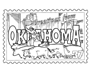
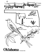
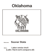
OK - Oklahoma Coloring Pages
Oklahoma Postage Stamp Coloring Page - USPS State Stamp
Oklahoma State Quarter Coloring Page - 50 State Quarter
Oklahoma State Flag Coloring Page - State Flag to Color
Oklahoma Map 1 Coloring Page - State Demographic Map to Color
Oklahoma Map 2 Coloring Page - Easy State Shape Outline Map
|
Oklahoma is the 28th most populous and 20th-largest state. A major producer of natural gas, oil and agriculture, Oklahoma relies on an
economic base of aviation, energy, telecommunications, and biotechnology.[5] It has one of the fastest growing economies in the nation,
ranking among the top states in per capita income growth and gross domestic product growth. Oklahoma City and Tulsa serve as Oklahoma's
primary economic anchors, with nearly 60 percent of Oklahomans living in their metropolitan statistical areas.
The name Oklahoma comes from the Choctaw phrase okla humma, literally meaning red people. Choctaw Chief Allen Wright suggested the name
in 1866 during treaty negotiations with the federal government regarding the use of Indian Territory, in which he envisioned an all-Indian
state controlled by the United States Superintendent of Indian Affairs. Equivalent to the English word Indian, okla humma was a phrase in
the Choctaw language used to describe the Native American race as a whole. Oklahoma later became the de facto name for Oklahoma Territory,
and it was officially approved in 1890, two years after the area was opened to white settlers.
Oklahoma is located in a temperate region and experiences occasional extremes of temperature and precipitation typical in a continental
climate. Most of the state lies in an area known as Tornado Alley characterized by frequent interaction between cold and warm air
masses producing severe weather.[20] An average 54 tornadoes strike the state per year-one of the highest rates in the world. Because of
its position between zones of differing prevailing temperature and winds, weather patterns within the state can vary widely between
relatively short distances
Please note, we gladly accept submissions from state and local government agencies and departments (Department(s) of tourism, agriculture, etc.)
for display of additional state coloring pages on our site. In addition we accept submissions from established and recognized industries, or local
places of interest (cities, parks, attractions) that may make available quality content that is specific to a particular state. Contact us if
you have the capability and authority to provide such content, we would be happy to promote your state, city, attraction, event, etc.!
*** State information courtesy of Wikipedia ***
|
|
|
|
|
|

|