


|
 |
 |
| |
State of Oregon Coloring Page Sheets
The 50 States coloring pages
|
|
Oregon coloring pages are a fun way to teach Pre-K through 3rd grade students history, geography and demographics,
and for elementary students to learn about their own (and other) states.
|
| LIST of States |
|
|

OR - Oregon Coloring Pages
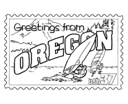
Oregon Postage Stamp Coloring Page - USPS State Stamp
Oregon State Quarter Coloring Page - 50 State Quarter
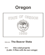
Oregon State Flag Coloring Page - State Flag to Color
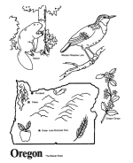
Oregon Map 1 Coloring Page - State Demographic Map to Color
Oregon Map 2 Coloring Page - Easy State Shape Outline Map
|
Oregon located on the Pacific coast, with Washington to the north, California to the south, Nevada on the southeast and Idaho to the east.
The Columbia and Snake rivers delineate much of Oregon's northern and eastern boundaries respectively. The area was inhabited by many
indigenous tribes before the arrival of traders, explorers and settlers who formed an autonomous government in Oregon Country in 1843;
the Oregon Territory was created in 1848, and Oregon became the 33rd state on February 14, 1859. Salem is the state's capital and
third-most-populous city; Portland is the most populous. Portland is the 30th-largest U.S. city, with a population of 582,130 (2009 estimate)
and a metro population of 2,241,841 (2009 estimate), the 23rd-largest U.S. metro area.
The valley of the Willamette River in western Oregon is the most densely populated and agriculturally productive region of the state,
and is home to eight of the ten most populous cities.
Oregon enjoys a diverse landscape including a scenic and windswept Pacific coastline, the volcanoes of a rugged and glaciated Cascade
Mountain Range, dense evergreen forests, and high desert across much of the eastern portion of the state. The towering Douglas firs and
redwoods along the rainy Western Oregon coast provide a dramatic contrast with the lower density and fire prone pine tree and juniper
forests covering portions of the Eastern half of the state. The eastern portion of the state also includes semi-arid scrublands, prairies,
deserts, and meadows. These drier areas stretch east from Central Oregon. Mount Hood is the highest point in the state at 11,249 feet.
Crater Lake National Park is the only national park in Oregon.
Please note, we gladly accept submissions from state and local government agencies and departments (Department(s) of tourism, agriculture, etc.)
for display of additional state coloring pages on our site. In addition we accept submissions from established and recognized industries, or local
places of interest (cities, parks, attractions) that may make available quality content that is specific to a particular state. Contact us if
you have the capability and authority to provide such content, we would be happy to promote your state, city, attraction, event, etc.!
*** State information courtesy of Wikipedia ***
|
|
|
|
|
|

|