


|
 |
 |
| |
State of Vermont Coloring Page Sheets
The 50 States coloring pages
|
|
Vermont coloring pages are a fun way to teach Pre-K through 3rd grade students history, geography and demographics,
and for elementary students to learn about their own (and other) states.
|
| LIST of States |
|
|

VT - Vermont Coloring Pages
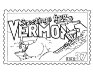
Vermont Postage Stamp Coloring Page - USPS State Stamp
Vermont State Quarter Coloring Page - 50 State Quarter
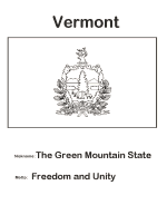
Vermont State Flag Coloring Page - State Flag to Color
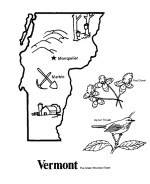
Vermont Map 1 Coloring Page - State Demographic Map to Color
Vermont Map 2 Coloring Page - Easy State Shape Outline Map
|
The only New England state with no coastline along the Atlantic Ocean, Vermont is notable for Lake Champlain (which makes up 50% of Vermont's
western border) and the Green Mountains, which run north to south. It is bordered by Massachusetts to the south, New Hampshire to the east,
New York to the west, and the Canadian province of Quebec to the north.
Originally inhabited by Native American tribes (Abenaki and Iroquois), much of the territory that is now Vermont was claimed by France but
became a British possession after France's defeat in the French and Indian War. For many years, the surrounding colonies disputed control
of the area (referred to at the time as the New Hampshire Grants) especially New Hampshire and New York. Settlers who held land titles
granted by these colonies were opposed by the Green Mountain Boys militia, which eventually prevailed in creating an independent state,
the Vermont Republic, founded during the Revolutionary War and lasting for 14 years; Vermont is thus one of 17 U.S. states (along with
Texas, Hawaii, the brief California Republic, and each of the original Thirteen Colonies) to have, at one point, existed as its own
sovereign government. In 1791, Vermont joined the United States as the fourteenth state, and the first outside the original Thirteen Colonies.
It is the leading producer of maple syrup in the United States. The state capital is Montpelier, and the largest city and metropolitan
area is Burlington. No other state has a largest city as small as Burlington, or a capital city as small as Montpelier.
Please note, we gladly accept submissions from state and local government agencies and departments (Department(s) of tourism, agriculture, etc.)
for display of additional state coloring pages on our site. In addition we accept submissions from established and recognized industries, or local
places of interest (cities, parks, attractions) that may make available quality content that is specific to a particular state. Contact us if
you have the capability and authority to provide such content, we would be happy to promote your state, city, attraction, event, etc.!
*** State information courtesy of Wikipedia ***
|
|
|
|
|
|

|